

Collection Highlights
EIGHTEENTH-CENTURY ENGLISH MANUSCRIPT BOOK [With 43 English County Maps by Thomas Kitchin]
![Product Image for EIGHTEENTH-CENTURY ENGLISH MANUSCRIPT BOOK [With 43 English County Maps by Thomas Kitchin]](https://secondstory.curiomarketplace.com/uploads/20240103/1704319632_fe36b321ed20b25b3a63.jpg "EIGHTEENTH-CENTURY ENGLISH MANUSCRIPT BOOK [With 43 English County Maps by Thomas Kitchin]")
![Product Image for EIGHTEENTH-CENTURY ENGLISH MANUSCRIPT BOOK [With 43 English County Maps by Thomas Kitchin]](https://secondstory.curiomarketplace.com/uploads/20240103/1704319634_063acce2096fe59cb08c.jpg "EIGHTEENTH-CENTURY ENGLISH MANUSCRIPT BOOK [With 43 English County Maps by Thomas Kitchin]")
![Product Image for EIGHTEENTH-CENTURY ENGLISH MANUSCRIPT BOOK [With 43 English County Maps by Thomas Kitchin]](https://secondstory.curiomarketplace.com/uploads/20240103/1704319636_5e526cfb591e269f543d.jpg "EIGHTEENTH-CENTURY ENGLISH MANUSCRIPT BOOK [With 43 English County Maps by Thomas Kitchin]")
![Product Image for EIGHTEENTH-CENTURY ENGLISH MANUSCRIPT BOOK [With 43 English County Maps by Thomas Kitchin]](https://secondstory.curiomarketplace.com/uploads/20240103/1704319638_c508280cec7151f1c43c.jpg "EIGHTEENTH-CENTURY ENGLISH MANUSCRIPT BOOK [With 43 English County Maps by Thomas Kitchin]")
![Product Image for EIGHTEENTH-CENTURY ENGLISH MANUSCRIPT BOOK [With 43 English County Maps by Thomas Kitchin]](https://secondstory.curiomarketplace.com/uploads/20240103/1704319641_65e5d7c70c8484b8729a.jpg "EIGHTEENTH-CENTURY ENGLISH MANUSCRIPT BOOK [With 43 English County Maps by Thomas Kitchin]")
![Product Image for EIGHTEENTH-CENTURY ENGLISH MANUSCRIPT BOOK [With 43 English County Maps by Thomas Kitchin]](https://secondstory.curiomarketplace.com/uploads/20240103/1704319643_5d6db2fe653066c890dc.jpg "EIGHTEENTH-CENTURY ENGLISH MANUSCRIPT BOOK [With 43 English County Maps by Thomas Kitchin]")
![Product Image for EIGHTEENTH-CENTURY ENGLISH MANUSCRIPT BOOK [With 43 English County Maps by Thomas Kitchin]](https://secondstory.curiomarketplace.com/uploads/20240103/1704319645_2772edd2e7c7e6ba6801.jpg "EIGHTEENTH-CENTURY ENGLISH MANUSCRIPT BOOK [With 43 English County Maps by Thomas Kitchin]")
![Product Image for EIGHTEENTH-CENTURY ENGLISH MANUSCRIPT BOOK [With 43 English County Maps by Thomas Kitchin]](https://secondstory.curiomarketplace.com/uploads/20240103/1704319647_03def7f563246dbabff5.jpg "EIGHTEENTH-CENTURY ENGLISH MANUSCRIPT BOOK [With 43 English County Maps by Thomas Kitchin]")
![Product Image for EIGHTEENTH-CENTURY ENGLISH MANUSCRIPT BOOK [With 43 English County Maps by Thomas Kitchin]](https://secondstory.curiomarketplace.com/uploads/20240103/1704319649_7e947b364f1b007c4b83.jpg "EIGHTEENTH-CENTURY ENGLISH MANUSCRIPT BOOK [With 43 English County Maps by Thomas Kitchin]")
![Product Image for EIGHTEENTH-CENTURY ENGLISH MANUSCRIPT BOOK [With 43 English County Maps by Thomas Kitchin]](https://secondstory.curiomarketplace.com/uploads/20240103/1704319651_33cc7798ccfcd95109ee.jpg "EIGHTEENTH-CENTURY ENGLISH MANUSCRIPT BOOK [With 43 English County Maps by Thomas Kitchin]")
![Product Image for EIGHTEENTH-CENTURY ENGLISH MANUSCRIPT BOOK [With 43 English County Maps by Thomas Kitchin]](https://secondstory.curiomarketplace.com/uploads/20240103/1704319653_7dc852961216a1647e28.jpg "EIGHTEENTH-CENTURY ENGLISH MANUSCRIPT BOOK [With 43 English County Maps by Thomas Kitchin]")
EIGHTEENTH-CENTURY ENGLISH MANUSCRIPT BOOK [With 43 English County Maps by Thomas Kitchin]
Place of Publication: [n.p.]
Publisher: [n.p.]
Publication Date: 1747 - 1760
More Details
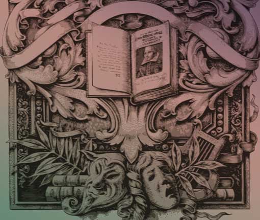
An eighteenth-century autograph manuscript book, containing descriptions of forty-three English counties and towns, each with an accompanying map by Thomas Kitchin. The compiler's identity is unknown, and the manuscript is prefaced by the following quatrain: "Whoever wrote this, wrote it well; / But who it was, I cannot tell. / Peruse it here, you will it admire, / And deem it worthy a grand sire." The handwritten text is comprised of excerpts from a series of articles profiling individual counties published in The London Magazine or; Gentleman's Monthly Intelligencer between 1747 and 1760. The maps were produced by Kitchin for Richard Baldwin's periodical, and those appearing here were excised from issues of the same.
The book appears to have been compiled over the course of the 13 years in which the source articles were published in The London Magazine. The entries (each containing between one and two pages of handwritten text, and a page with a corresponding mounted map) are numbered, and appear in reverse order in two "volumes". The entry for Lincolnshire ("No. 21") occurs first, and the entry for Bedfordshire ("No. 1") closes out what the compiler identified as "Volume 1". Each volume is appended by a handwritten contents pages, and the numbered sequence of entries is alphabetical. "Volume 2" includes entry numbers 22 - 43 (Middlesex - W. Riding), also in reverse order. Each entry is separated by a blank leaf.
Two other maps are present. The first mounted map (appearing on "page 1") is an unidentified 18th-century map of London and its nearby environs. Laid in at the front is a map of western France, apparently unrelated to the other contents of the manuscript. The map, entitled Partie Occidentale de L'Empire Francais, was engraved by Chamouin and drawn by Giraldon. It was excised from Malte Brun's 1812 Atlas Complet Du Precis De La Geographie Universelle. There are a total of 45 maps, 44 mounted and one laid in.
Oblong Quarto, [99 leaves]. In Good condition. Bound in full 18th-century marbled papers boards. Boards show moderate plus wear to all edges and corners, and moderate soiling and age toning overall. Text block has moderate uneven age toning throughout, light soiling to some pages, and light wear edges. Mounted maps show occasional light soiling, light to moderate age toning, and some minor ink emendations. MJ Consignment. NOTE: Shelved in Room G.
Item:
1371750
![EIGHTEENTH-CENTURY ENGLISH MANUSCRIPT BOOK [With 43 English County Maps by Thomas Kitchin]](https://secondstory.curiomarketplace.com/img/thumbs/items/filmstrip/1704319632_fe36b321ed20b25b3a63.jpg)
![EIGHTEENTH-CENTURY ENGLISH MANUSCRIPT BOOK [With 43 English County Maps by Thomas Kitchin]](https://secondstory.curiomarketplace.com/img/thumbs/items/filmstrip/1704319634_063acce2096fe59cb08c.jpg)
![EIGHTEENTH-CENTURY ENGLISH MANUSCRIPT BOOK [With 43 English County Maps by Thomas Kitchin]](https://secondstory.curiomarketplace.com/img/thumbs/items/filmstrip/1704319636_5e526cfb591e269f543d.jpg)
![EIGHTEENTH-CENTURY ENGLISH MANUSCRIPT BOOK [With 43 English County Maps by Thomas Kitchin]](https://secondstory.curiomarketplace.com/img/thumbs/items/filmstrip/1704319638_c508280cec7151f1c43c.jpg)
![EIGHTEENTH-CENTURY ENGLISH MANUSCRIPT BOOK [With 43 English County Maps by Thomas Kitchin]](https://secondstory.curiomarketplace.com/img/thumbs/items/filmstrip/1704319641_65e5d7c70c8484b8729a.jpg)
![EIGHTEENTH-CENTURY ENGLISH MANUSCRIPT BOOK [With 43 English County Maps by Thomas Kitchin]](https://secondstory.curiomarketplace.com/img/thumbs/items/filmstrip/1704319643_5d6db2fe653066c890dc.jpg)
![EIGHTEENTH-CENTURY ENGLISH MANUSCRIPT BOOK [With 43 English County Maps by Thomas Kitchin]](https://secondstory.curiomarketplace.com/img/thumbs/items/filmstrip/1704319645_2772edd2e7c7e6ba6801.jpg)
![EIGHTEENTH-CENTURY ENGLISH MANUSCRIPT BOOK [With 43 English County Maps by Thomas Kitchin]](https://secondstory.curiomarketplace.com/img/thumbs/items/filmstrip/1704319647_03def7f563246dbabff5.jpg)
![EIGHTEENTH-CENTURY ENGLISH MANUSCRIPT BOOK [With 43 English County Maps by Thomas Kitchin]](https://secondstory.curiomarketplace.com/img/thumbs/items/filmstrip/1704319649_7e947b364f1b007c4b83.jpg)
![EIGHTEENTH-CENTURY ENGLISH MANUSCRIPT BOOK [With 43 English County Maps by Thomas Kitchin]](https://secondstory.curiomarketplace.com/img/thumbs/items/filmstrip/1704319651_33cc7798ccfcd95109ee.jpg)
![EIGHTEENTH-CENTURY ENGLISH MANUSCRIPT BOOK [With 43 English County Maps by Thomas Kitchin]](https://secondstory.curiomarketplace.com/img/thumbs/items/filmstrip/1704319653_7dc852961216a1647e28.jpg)